3D Plane Fitting
Operator Function
Fit a plane based on the input region parameters and output the plane parameters. If the transform point cloud option is enabled, adjust the input point cloud region to the xoy plane based on the plane parameters.
Parameter Introduction
Input Parameters

| Parameter | Range | Default Value | Description | Illustration |
|---|---|---|---|---|
| Input Image | 0-8 | 0 | IM number for image input | |
Calculation Parameters
| Parameter | Range | Default Value | Description | Image |
|---|---|---|---|---|
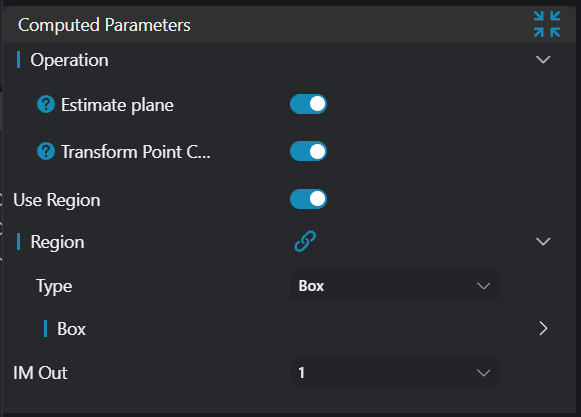
| Estimate Plane | true/false | true | If enabled, perform plane fitting based on the input region and output the corresponding plane parameters to registers | 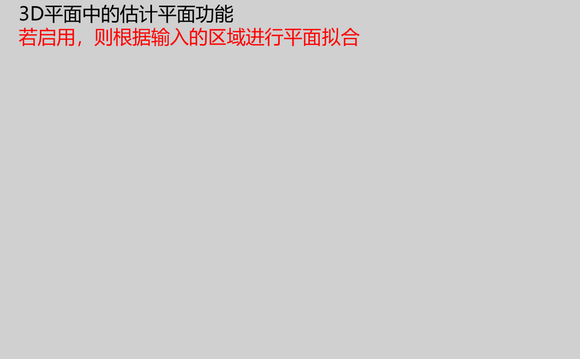 |
| Transform Point Cloud | true/false | true | If enabled, adjust the input point cloud image to the xoy plane, i.e., the zero plane | 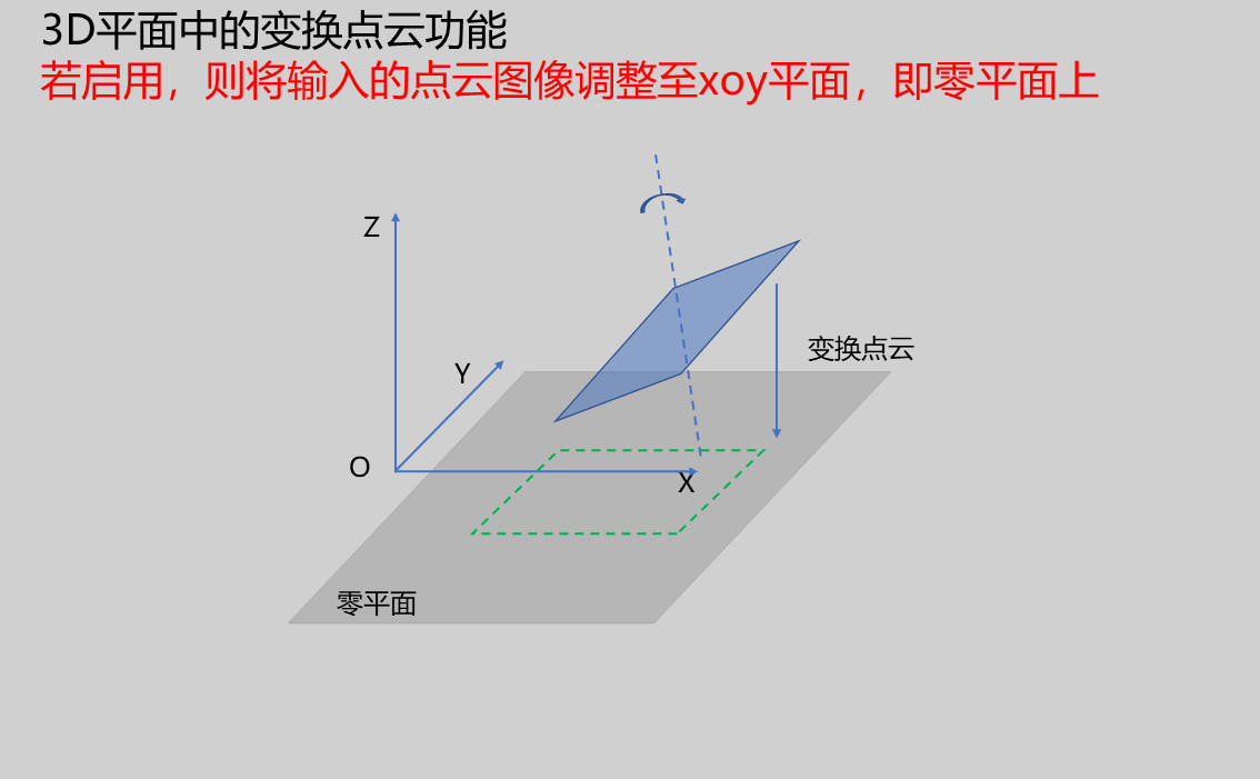 |
| Region | Set the region range for plane estimation and point cloud transformation | |||
| Output Image | 0-8 | 0 | IM number for image output |
Result Display
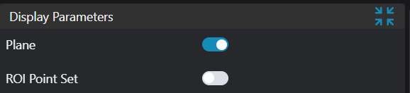
| Parameter | Range | Default Value | Description | Illustration |
|---|---|---|---|---|
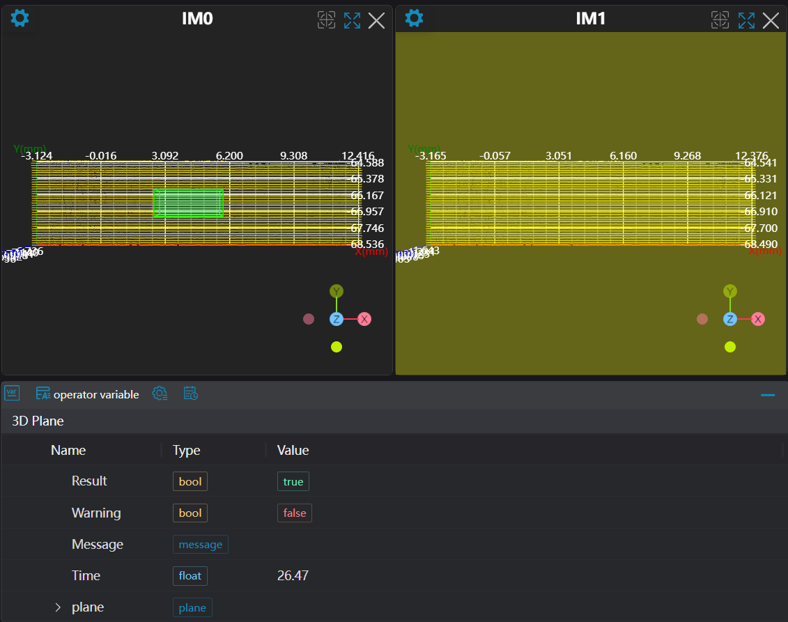
| Plane | true/false | false | Plane fitted using the input region. If enabled, display in the image | |
| ROI Point Set | true/false | false | Region point set selected by ROI box. If enabled, display in the image |
Output Parameters
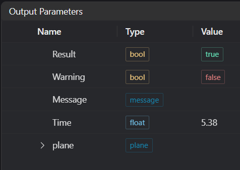
| Name | Type | Range | Description |
|---|---|---|---|
| Result | bool | true/false | true for success false for failure |
| Warning | bool | true/false | true indicates a warning false indicates no warning |
| Message | string | Output success, error, or warning messages. Empty if no error or warning. | |
| Time | float | Operator execution time, unit: ms | |
| plane | plane | Plane parameters |
Exception Troubleshooting
| No. | Exception Information | Corresponding Parameter | Solution |
|---|---|---|---|
| 1 | No algorithm function specified! Please select at least one function | Select at least one function from Estimate Plane and Transform Point Cloud | |
| 2 | Input value is {0}, invalid region type | Region Type | Only window2d, box, pointset supported |
| 3 | Region is empty | 1. Check if input point cloud is empty 2. Check if ROI region selects point cloud 3. Check if bound pointset is empty |
Example Introduction
Engineering Design
Select the
Load 3D Point Cloudtool to load the required 3D point cloud image to IM0.Select the
3D Region Operationtool to obtain the region needed for plane fitting.Select the
3D Plane Fittingtool to measure the profile step from point to point and point to line respectively.
Tool Usage
Select the input image for the operation. The image number must match the IM number where the image is located in the project.
Set the region:
Bind the region obtained from the previous step's 3D Region Operation tool.
Set the parameters.
Check the content you want to display in the result display section.
Click
Testto check if the image window and parameters meet expectations.If there are no issues, click
Save. Run the operator in the run list, and then view the running results in the corresponding IM.